Customize Latitude and Longitude Templates
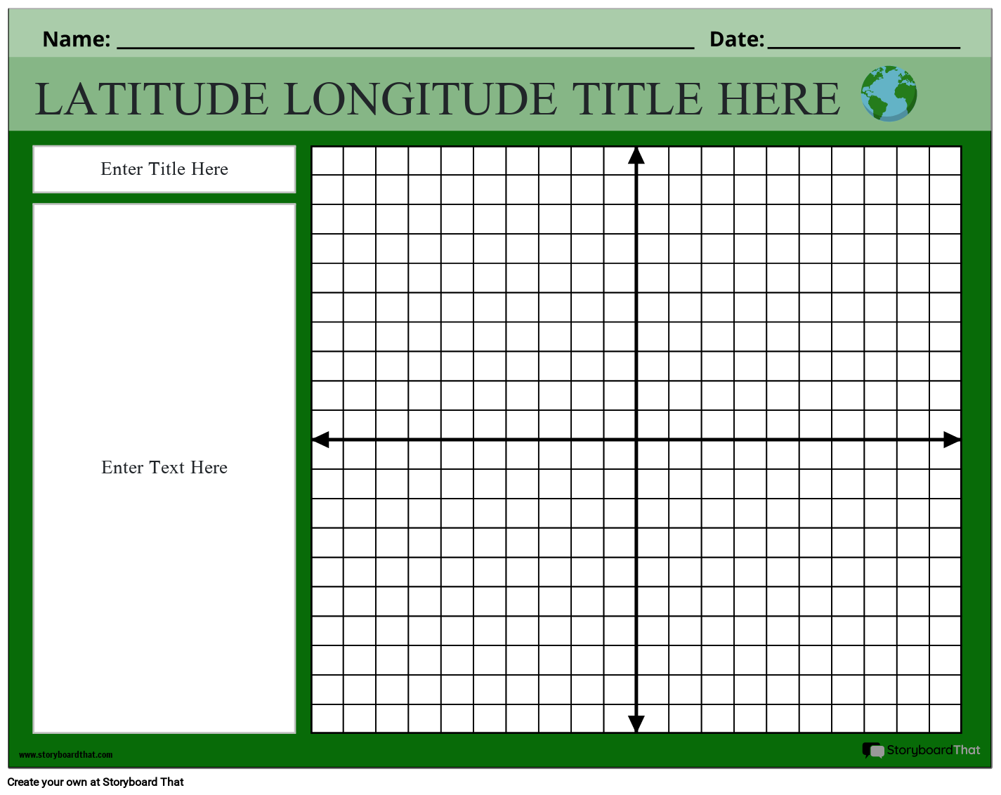
If you're assigning this to your students, copy the worksheet to your account and save. When creating an assignment, just select it as a template!

What are Latitude and Longitude?
Latitude is a geographical coordinate that measures the distance north or south of the Earth's equator. It is expressed in degrees, with values ranging from 0° at the equator to 90° at the North and South Poles. Latitude helps determine a location's position in the Northern Hemisphere or the Southern Hemisphere.
Longitude is a geographical coordinate that measures the distance east or west of the prime meridian. The prime meridian, located in Greenwich, London, serves as the reference point for measuring longitude. Longitude values range from 0° at the prime meridian to 180° in both the eastern and western hemispheres.
Difference Between Longitude and Latitude
Longitude and latitude are both important components of the geographic coordinate system used to identify and locate places on Earth. While they are related, there are distinct differences between them.
Latitude refers to the angular distance north or south of the equator, which is designated as 0 degrees latitude. Latitude lines, also known as parallels, run horizontally around the Earth, parallel to the equator. The lines of latitude are measured in degrees, ranging from 0 degrees at the equator to 90 degrees at the poles. Latitude is used to determine a location's position in either the northern or southern hemisphere.
On the other hand, longitude refers to the angular distance east or west of the prime meridian, which is designated as 0 degrees longitude and passes through Greenwich, London. Longitude lines, also known as meridians, run vertically from the North Pole to the South Pole, crossing the equator. The lines of longitude are measured in degrees, ranging from 0 degrees at the prime meridian to 180 degrees both east and west. Longitude is used to determine a location's position in either the eastern or western hemisphere.
One of the key differences between longitude and latitude is their orientation. Latitude lines are parallel to each other and remain at a consistent distance from each other, while longitude lines converge at the poles. Another difference is that longitude lines are not equal in length. They converge towards the poles, becoming closer together.
Longitude is particularly significant for determining time zones. The Earth is divided into 24 time zones, each approximately 15 degrees of longitude wide, with the prime meridian serving as the reference point for calculating time differences.
While latitude and longitude are primarily used for mapping and navigation, they also have applications in various other fields. Latitude helps determine climate zones and influences factors such as temperature and precipitation patterns. Longitude is essential for calculating accurate time, which is crucial for coordinating activities across different regions and time zones.
In summary, latitude and longitude are integral components of the geographic coordinate system. Latitude determines a location's position in the north-south direction, while longitude determines its position in the east-west direction. Together, these coordinates allow us to navigate, find locations, and understand our world in a spatial context.
Latitude and Longitude Worksheet: Navigating the World's Coordinates
They fundamental geographical concepts that allow us to precisely locate points on the Earth's surface. By understanding latitude and longitude coordinates, students understand global geography and enhance their navigational skills on apps such as Google Maps and Google Earth.
Latitude and longitude worksheets provide valuable practice for students to grasp these concepts effectively. These worksheets often include maps, coordinates, and various exercises that help students become familiar with latitude and longitude coordinates.
By using a latitude and longitude worksheet, students can identify specific locations on a world map, determine the latitude and longitude coordinates of given points, and understand the relationship between latitude and longitude lines. These worksheets also introduce students to the worldwide time zone system, as well as the different hemispheres of the Earth - northern, southern, eastern, and western hemispheres.
These latitude and longitude worksheets are readily available online for free, providing educators with easy access to these valuable resources. Printable worksheets and interactive online exercises allow students to practice and reinforce their understanding of latitude and longitude.
An answer key or solution guide is often provided with latitude and longitude worksheets, allowing students to check their answers and gain immediate feedback. This promotes independent learning and self-assessment, helping students monitor their progress and identify areas for improvement.
By engaging with latitude and longitude worksheets, students develop critical thinking skills, enhance their spatial awareness, and strengthen their understanding of geographic coordinates. These worksheets serve as essential tools for educators to teach students about latitude and longitude effectively.
Explore the Different Types of Latitude and Longitude Worksheets on Our Website
These worksheets are designed to help develop comprehension of latitude and longitude coordinates, as well as enhance their map-reading skills. Whether you're looking to practice locating specific places on a map, understand the significance of different hemispheres, or improve your knowledge of state capitals, we have you covered. Engage in interactive activities and challenges that make learning latitude and longitude enjoyable and accessible. Here are the variety of worksheets you can access in our website:
- Longitude Coordinates Worksheets: Engaging exercises that strengthen your understanding of longitude values and how to interpret them on maps.
- Latitude Worksheets: Develop your skills in locating places based on latitude values and understanding the concept of different latitudes in relation to the equator.
- Latitude and Longitude Worksheets for Kids: Specially designed worksheets with child-friendly language and visuals to make learning enjoyable and accessible for young learners.
- Latitude and Longitude Practice Worksheets: Challenge yourself by applying your knowledge of latitude and longitude in real-world scenarios, such as locating state capitals and finding specific locations on a map.
- Coverage of Northern and Southern Hemispheres: Gain a comprehensive understanding of latitude and longitude coordinates by exploring exercises that cover both the northern and southern hemispheres.
- Coverage of Western and Eastern Hemispheres: Develop a well-rounded knowledge of global coordinates with worksheets that encompass both the eastern and western hemispheres.
Start your exploration of longitude and latitude worksheets on our website today. Dive into the exciting world of geographic coordinates and enhance your skills in locating and understanding the world around you. Don't forget to check out our variety of worksheet templates, including map worksheet templates, and social studies vocabulary templates for even more educational resources. Start exploring today and broaden your students’ learning horizons!
How to Make a Latitude/Longitude Worksheet
Choose One of the Premade Templates
We have lots of templates to choose from. Take a look at our example for inspiration!
Click on “Copy Template”
Once you do this, you will be directed to the storyboard creator.
Give Your Worksheet a Name!
Be sure to call it something related to the topic so that you can easily find it in the future.
Edit Your Worksheet
This is where you will include directions, specific images, and make any aesthetic changes that you would like. The options are endless!
Click "Save and Exit"
When you are finished, click this button in the lower right hand corner to exit your storyboard.
Next Steps
From here you can print, download as a PDF, attach it to an assignment and use it digitally, and more!
Happy Creating!
Frequently Asked Questions About Latitude and Longitude
What are longitude coordinates?
They are the angular measurements that indicate the position of a location east or west of the Prime Meridian. They are used in conjunction with latitude coordinates to pinpoint precise locations on Earth's surface.
Where can I find latitude and longitude practice worksheets?
At Storyboard That, we offer a variety of handouts on our website. They are specifically designed to help learners strengthen their skills in understanding and using latitude and longitude coordinates. With engaging activities and clear instructions, our templates make learning geography fun and interactive.
Do you have longitude and latitude worksheets for kids?
Absolutely! At Storyboard That, we have a special collection of handouts designed specifically for kids to learn about longitude and latitude. Our longitude and latitude worksheets for kids are interactive and engaging, making the learning process enjoyable.
How to use latitude and longitude?
Latitude and longitude are primarily used for locating and identifying specific places on Earth's surface. They are essential for navigation, mapping, and determining precise coordinates for geographic positions.
© 2026 - Clever Prototypes, LLC - All rights reserved.
StoryboardThat is a trademark of Clever Prototypes, LLC, and Registered in U.S. Patent and Trademark Office


