Lesson Plan Overview
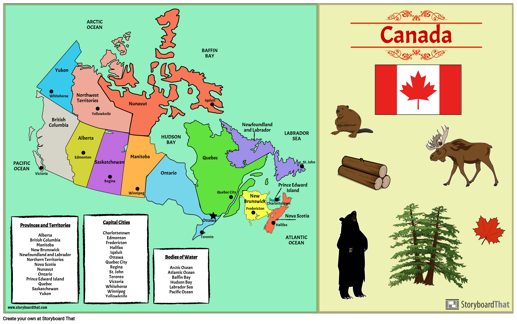
It is important for students to know the locations of the provinces and territories on a map, and the capital cities of each. Filling out a blank map or creating a map from scratch helps students retain information in a more concrete way. For this activity, students will create a poster showing Canada’s 10 provinces, 3 territories, capitals, and any major bodies of water. Students will also add illustrations that apply, like animals, symbols, geography, and more. Students may use a blank map of Canada, or use the template provided to create their own map.
Template and Class Instructions
(These instructions are completely customizable. After clicking "Copy Activity", update the instructions on the Edit Tab of the assignment.)
Due Date:
Objective: Fill in or create a blank map of Canada, including the provinces and territories, capital cities, major bodies of water, and illustrations like symbols, resources, or wildlife.
Student Instructions:
- Click “Start Assignment”.
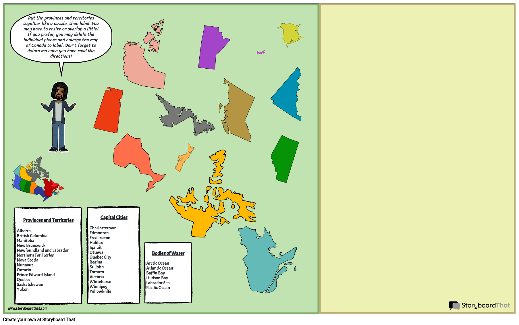
- Fill in the blank map of Canada including the provinces and territories, capital cities, and major bodies of water, OR create a map of your own using the template provided.
- Add illustrations throughout the map as desired to make it more colorful and interesting.
Lesson Plan Reference
How Tos about Canadian Provinces, Territories, and Capitals
Organize a classroom map quiz for active learning
Boost engagement by turning map review into a fun quiz game. Quizzes help students recall information faster and deepen their understanding of Canadian geography.
Prepare a set of map quiz questions
Create questions about provinces, territories, capitals, and major bodies of water. Mix in visual clues or have students point to locations on a blank map for added challenge.
Divide students into small teams
Form groups of 3–4 to encourage collaboration and support peer learning. This lets students discuss answers and builds confidence.
Run the quiz using maps or projectors
Ask questions aloud and have teams indicate answers on printed maps or a projected image. Rotate question types to keep everyone involved and excited.
Review answers as a class and celebrate progress
Go over correct answers together. Offer positive feedback and small rewards to motivate future learning.
Frequently Asked Questions about Canadian Provinces, Territories, and Capitals
What are the provinces and territories of Canada and their capital cities?
Canada has 10 provinces and 3 territories, each with its own capital city. For example, Ontario's capital is Toronto, and Nunavut's capital is Iqaluit. Learning all of them helps students understand Canadian geography.
How can I teach students to remember Canadian provinces and capitals easily?
Use interactive activities like filling in blank maps, creating colorful posters, or adding symbols and animals to help students memorize provinces and capitals in a fun, engaging way.
What’s a simple classroom activity for learning Canadian provinces, territories, and capitals?
Have students fill in or create a blank map of Canada, labeling each province, territory, and capital city, and decorating with relevant illustrations such as animals or major bodies of water.
Why is it important for students to learn the locations of Canadian provinces, territories, and capitals?
Understanding the locations of provinces, territories, and capitals helps students build a strong foundation in geography and fosters a deeper appreciation of Canada’s diversity.
What are some creative ideas to make a Canadian geography poster engaging for grade 4-5 students?
Encourage students to add illustrations of native animals, provincial symbols, and geographic features, and use bright colors to make their Canadian geography posters more engaging and memorable.
More Storyboard That Activities
Geography of Canada
Testimonials

“By using the product, they were so excited and they learned so much...”–K-5 Librarian and Instructinal Technology Teacher

“I'm doing a Napoleon timeline and I'm having [students] determine whether or not Napoleon was a good guy or a bad guy or somewhere in between.”–History and Special Ed Teacher

“Students get to be creative with Storyboard That and there's so many visuals for them to pick from... It makes it really accessible for all students in the class.”–Third Grade Teacher
© 2026 - Clever Prototypes, LLC - All rights reserved.
StoryboardThat is a trademark of Clever Prototypes, LLC, and Registered in U.S. Patent and Trademark Office


