Lesson Plan Overview
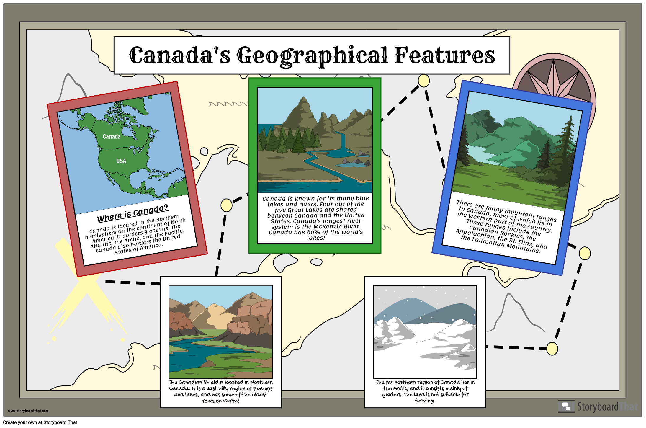
The geography of Canada is diverse and impressive, with features such as several lakes, vast mountain ranges, rolling central plains, rivers, and forests. The Canadian Shield, which is a hilly region of swamps and lakes, is a large part of Northern Canada. The northern part of Canada is cold, icy, and filled with glaciers. For this activity, students will create a poster that highlights some of the beautiful geographical features that Canada has to offer.
You can find more travel poster templates to add to this assignment to give students a variety of choices for their poster!
Template and Class Instructions
(These instructions are completely customizable. After clicking "Copy Activity", update the instructions on the Edit Tab of the assignment.)
Due Date:
Objective: Create a poster highlighting the geographical features of Canada.
Student Instructions:
- Click “Start assignment”.
- Using school resources, conduct research about the geography of Canada.
- Create a poster about Canadian geography, including facts and illustrations.
Lesson Plan Reference
Student Rubric
(You can also create your own on Quick Rubric.)
| Proficient | Emerging | Beginning | |
|---|---|---|---|
| Written Work | If there is writing, it is clear and uses complete sentences. | If there is writing, it is somewhat clear and uses some complete sentences. | If there is writing, it is incomplete and unclear. |
| Illustrations | The illustrations represent the assignment using appropriate scenes, characters and items. | The illustrations relate to the assignment, but are difficult to understand. | The illustrations do not clearly relate to the assignment. |
| Evidence of Effort | Work is well written and carefully thought out. | Work shows some evidence of effort. | Work shows little evidence of any effort. |
| Conventions | Spelling, grammar, and punctuation are mostly correct. | Spelling, grammar, and punctuation are somewhat correct. | Spelling, grammar, and punctuation are mostly incorrect. |
How Tos about Canadian Geography Poster
Organize a collaborative Canadian geography mural in your classroom
Invite your students to work together to create a large mural that showcases Canada's diverse geography. This hands-on project helps students visualize and understand different regions while building teamwork skills.
Divide the mural into regional sections
Assign groups or pairs of students to focus on different Canadian regions, such as the Canadian Shield, Rocky Mountains, or Great Lakes. This ensures each area is represented and encourages focused research.
Guide students to research and select key features
Ask each group to find interesting facts and images about their assigned region’s geography. Encourage them to include landforms, climate, and wildlife in their research.
Provide art supplies for creating colorful illustrations
Set out markers, colored pencils, construction paper, and other materials. Encourage students to use bright visuals and creative labeling to make each region stand out on the mural.
Display and present the completed mural
Hang the finished mural in a visible spot. Have each group briefly present their section, sharing unique facts and explaining their artistic choices to the class for a fun, educational showcase.
Frequently Asked Questions about Canadian Geography Poster
What are some key geographical features of Canada students should include on a poster?
Key geographical features of Canada to include are the Canadian Shield, the Rocky Mountains, Great Lakes, vast forests, central plains, major rivers like the St. Lawrence, and the icy, glacier-filled northern regions.
How can I help my students research Canadian geography for a classroom poster project?
Guide students to use school resources such as atlases, library books, and reliable educational websites. Encourage them to look for maps, photos, and fun facts about Canada's landforms and climate for their posters.
What is the Canadian Shield and why is it important in Canadian geography?
The Canadian Shield is a massive region of ancient rock, swamps, and lakes covering much of northern Canada. It is important for its unique landscape, natural resources, and influence on Canada's environment and settlement patterns.
What are creative ideas for making a Canadian geography poster engaging for grade 4-5 students?
Use bright colors, labeled maps, drawings of animals or landmarks, and fun facts. Encourage students to add illustrated symbols for mountains, lakes, and forests to make the poster visually appealing and educational.
Why is learning about Canadian geography important for elementary students?
Learning about Canadian geography helps students understand their country's diversity, natural resources, and history. It builds map skills and appreciation for different regions, supporting broader social studies goals.
More Storyboard That Activities
Geography of Canada
Testimonials

“By using the product, they were so excited and they learned so much...”–K-5 Librarian and Instructinal Technology Teacher

“I'm doing a Napoleon timeline and I'm having [students] determine whether or not Napoleon was a good guy or a bad guy or somewhere in between.”–History and Special Ed Teacher

“Students get to be creative with Storyboard That and there's so many visuals for them to pick from... It makes it really accessible for all students in the class.”–Third Grade Teacher
© 2026 - Clever Prototypes, LLC - All rights reserved.
StoryboardThat is a trademark of Clever Prototypes, LLC, and Registered in U.S. Patent and Trademark Office


