Lesson Plan Overview
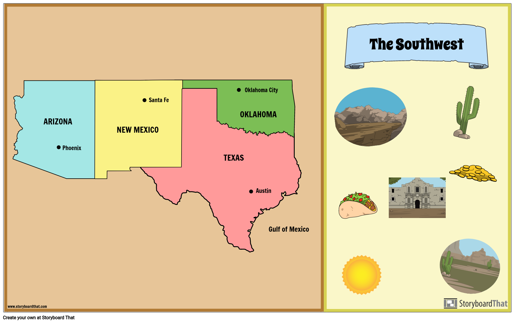
It is important for students to know the locations of the states on a map, and the capital cities of each state. Filling out a blank map or creating a map from scratch helps students retain information in a more concrete way. For this activity, students will create a poster showing the Southwest states, capitals, and any major bodies of water. Students will also add illustrations that apply to the Southwest. Students may use a map of the United States, or use the individual states template provided to create their own map.
Template and Class Instructions
(These instructions are completely customizable. After clicking "Copy Activity", update the instructions on the Edit Tab of the assignment.)
Due Date:
Objective: Create a map of the Southwest region, including the state names, capital cities, and illustrations.
Student Instructions
- Click “Start Assignment”.
- Fill in the blank map of the Southwest, including states and capitals OR create a map of your own using the individual states provided. Use the "search" bar to find regions and states.
- Add illustrations throughout the map as desired to make it more colorful and interesting.
Lesson Plan Reference
How Tos about Southwest Region Map
Organize a classroom map challenge for Southwest state capitals
Increase engagement by dividing students into small teams and having each team race to label blank maps with the correct Southwest state names and capitals. Offer small prizes or certificates to boost motivation and reinforce learning.
Set clear rules and time limits
Maintain fairness by explaining the challenge rules, including how teams can use resources like atlas pages or wall maps, and setting a time limit (e.g., 10 minutes) to keep the activity fast-paced and fun.
Encourage creative map decorations
Promote creativity by inviting students to add illustrations or symbols that represent each state (such as cacti for Arizona or cowboy hats for Texas) after labeling, making maps memorable and unique.
Review answers together as a class
Reinforce knowledge by projecting a completed map and asking teams to compare their answers, highlighting correct responses and discussing any mistakes to support collaborative learning.
Display top maps and celebrate effort
Build classroom pride by showcasing standout maps on a bulletin board and recognizing all teams for their teamwork and improvement.
Frequently Asked Questions about Southwest Region Map
What are the Southwest region states and their capitals?
The Southwest region of the United States typically includes Arizona (Phoenix), New Mexico (Santa Fe), Oklahoma (Oklahoma City), and Texas (Austin). These states make up the core of the Southwest in most educational maps and activities.
How can students create a Southwest region map for a class project?
Students can create a Southwest region map by labeling each state and its capital, adding major bodies of water, and illustrating features unique to the region. They may use a blank US map or cutouts of individual states for a custom layout.
What are some fun illustration ideas for a Southwest region map poster?
Consider adding cacti, desert landscapes, the Grand Canyon, Native American symbols, and southwestern wildlife like roadrunners or coyotes. These visuals make the map engaging and help represent the region's unique culture and geography.
Why is mapping states and capitals important for elementary students?
Mapping states and capitals helps students visualize geography, improves memory retention, and builds essential skills in spatial awareness and regional understanding, which are key components of elementary social studies.
What are effective tips for teaching US regions like the Southwest?
Encourage hands-on activities like filling in blank maps, creating posters, using interactive digital tools, and adding artwork. These methods help students actively engage with content and better remember state locations and capitals.
More Storyboard That Activities
US Regions: Southwest
Testimonials

“By using the product, they were so excited and they learned so much...”–K-5 Librarian and Instructinal Technology Teacher

“I'm doing a Napoleon timeline and I'm having [students] determine whether or not Napoleon was a good guy or a bad guy or somewhere in between.”–History and Special Ed Teacher

“Students get to be creative with Storyboard That and there's so many visuals for them to pick from... It makes it really accessible for all students in the class.”–Third Grade Teacher
© 2026 - Clever Prototypes, LLC - All rights reserved.
StoryboardThat is a trademark of Clever Prototypes, LLC, and Registered in U.S. Patent and Trademark Office


